Coverage
Areas we serve
Genuinely local service across Gresham.
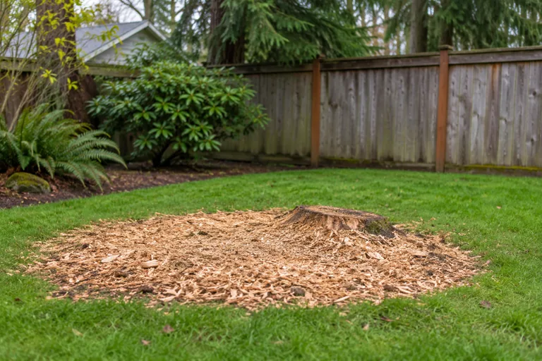
Rockwood
Rockwood extends from the western city boundary toward 202nd and Birdsdale, with Glisan above and Eleven Mile and Market along the southern …
Details →
Centennial
The City describes the Gresham Centennial boundary with references to NW Eleven Mile Avenue, Fairview Creek and the Springwater trail.…
Details →
Central City
Central City sits between Burnside and Powell, with Hogan and Eastman Parkway marking its sides in the city neighborhood description.…
Details →Gresham Butte
The Gresham Butte boundary follows parts of the Springwater Trail and Towle Road and extends toward the southern city boundary.…
Details →
Gresham Pleasant Valley
The city describes Gresham Pleasant Valley using McKinley Road, Pleasant View Road and the city and county boundaries; annexation status mat…
Details →Historic Southeast
Historic Southeast is south of Powell Boulevard near Hogan Road and Roberts Avenue, according to the city neighborhood description.…
Details →Hogan Cedars
Hogan Cedars lies within boundaries described using Hogan, Burnside and Highway 26, with the Springwater Trail and city edge to the south.…
Details →Hollybrook
Hollybrook is framed by Powell, Eastman Parkway, the Springwater Trail and Pleasant View Drive in the city neighborhood information.…
Details →Kelly Creek
The City places Kelly Creek east of Highway 26 and south of Powell Valley Road, extending to the city limits.…
Details →North Central
North Central reaches from Glisan toward Burnside, with NE 202nd Avenue and the Hogan corridor appearing in the city boundary description.…
Details →North Gresham
The city places North Gresham above Glisan, east of 181st Avenue, extending to the northern and eastern city limits.…
Details →Northeast Gresham
Northeast Gresham is described using Stark and Division, with Hogan to the west and the city boundary to the east.…
Details →Northwest Gresham
Northwest Gresham includes a boundary following Powell, the former traction corridor, Burnside and Eastman Parkway in the city neighborhood …
Details →Powell Valley
The city neighborhood description places Powell Valley between Division and Powell Boulevard, with Burnside and the eastern city limit defin…
Details →Southwest Gresham
The Southwest neighborhood boundary references the Springwater Corridor, Heiney Road, Binford Lake Parkway and Towle Avenue, with city limit…
Details →Wilkes East
Wilkes East includes the Glisan, 162nd, 181st and Sandy corridors in the city boundary description; distinguish it from similarly named Port…
Details →Troutdale
Troutdale is a separate city east of Gresham in the East County area.…
Details →Fairview
Fairview is a separate city near Gresham and Wood Village.…
Details →Wood Village
Wood Village is its own city in the East County area near Gresham.…
Details →Damascus
Damascus-area properties can involve Clackamas County land-use and service questions.…
Details →Happy Valley
Happy Valley is a separate city in Clackamas County.…
Details →Boring
Boring is a community in Clackamas County southeast of Gresham.…
Details →Sandy
Sandy is a separate city along the Highway 26 corridor east of Gresham.…
Details →Corbett
Corbett is an unincorporated East Multnomah County community.…
Details →Springdale
Springdale is an East Multnomah County community in the Corbett area.…
Details →Pleasant Home
Pleasant Home is a community in the eastern Gresham area.…
Details →Orient
Orient is a community near the eastern Gresham area.…
Details →East Portland
East Portland covers neighborhoods west of Gresham within Portland.…
Details →Powellhurst-Gilbert
Powellhurst-Gilbert is a Portland neighborhood west of Gresham.…
Details →Lents
Lents is a Portland neighborhood. The city neighborhood page lists Lents Park and the Foster Floodplain Natural Area among its parks and nat…
Details →Argay Terrace
Portland identifies Argay Terrace with Argay Park and the Columbia Slough landscape.…
Details →Parkrose
Sandy Boulevard is a local commercial reference in Portland’s description of Parkrose.…
Details →Parkrose Heights
Parkrose Heights is described by the city with references to I-84, the airport area and 102nd Avenue.…
Details →Russell
The city places Russell around the area northeast of 122nd Avenue and Halsey Street.…
Details →Wilkes
Wilkes is a northeast Portland neighborhood with I-84 and the Columbia River area among its city-described references.…
Details →Glenfair
Glenfair Park anchors the city description of Glenfair, next to Hazelwood, Wilkes and Centennial.…
Details →Hazelwood
Portland places Gateway Transit Center and Mall 205 among Hazelwood’s local landmarks.…
Details →Mill Park
Mill Park’s city page lists Floyd Light Park and the East Portland Community Center among local references.…
Details →Portland Centennial
Portland’s Centennial neighborhood meets Gresham and lies north of Powell Butte Nature Park.…
Details →Portland Pleasant Valley
Portland associates Pleasant Valley with the Johnson Creek watershed and nearby natural areas.…
Details →Montavilla
The city describes Montavilla using I-84 and I-205 as northern and eastern references.…
Details →Madison South
Rocky Butte and NE 82nd Avenue are local reference points in the city description of Madison South.…
Details →Roseway
Portland places Roseway beside Rose City Park, Cully, Sumner, Madison South and Beaumont-Wilshire.…
Details →Rose City Park
The city lists Normandale Park, Frazer Park and the Rose City Golf Course area in its Rose City Park description.…
Details →Cully
Cully Park and Kʰunamokwst Park appear in the city neighborhood information for Cully.…
Details →Sumner
Portland’s Sumner page identifies local garden activity and Johnson Lake Natural Area.…
Details →Woodland Park
Woodland Park is a small northeast Portland neighborhood around the Halsey and 102nd Avenue corridors.…
Details →South Tabor
South Tabor is south of Mt. Tabor Park; the city identifies Franklin High School and Clinton Park nearby.…
Details →Mt. Tabor
Mt. Tabor is the Portland neighborhood around the volcanic hill and its namesake park.…
Details →North Tabor
North Tabor sits among Rose City Park, Laurelhurst, Mt. Tabor and Montavilla in the city description.…
Details →Foster-Powell
Portland’s Foster-Powell neighborhood page lists Essex Park, Kern Park and Laurelwood Park.…
Details →Brentwood-Darlington
The city describes Brentwood-Darlington between the 45th and 82nd Avenue area, south of Duke toward the county line.…
Details →Mt. Scott-Arleta
Mt. Scott-Arleta is described using Foster, Duke, 60th Avenue and 82nd Avenue as neighborhood references.…
Details →Creston-Kenilworth
Creston Park and Kenilworth Park are named in Portland’s Creston-Kenilworth neighborhood information.…
Details →Richmond
Richmond includes the Hawthorne and Clinton/Division districts in the city neighborhood description.…
Details →Woodstock
SE Woodstock Boulevard is the neighborhood’s main business reference, and Woodstock Park appears in the city directory.…
Details →Brooklyn
Brooklyn is an older east-side neighborhood with a residential area and Willamette frontage in the city description.…
Details →Reed
Portland describes Reed as a residential neighborhood with many mid-century homes and some earlier farmhouses.…
Details →Sellwood-Moreland
Sellwood-Moreland’s city description highlights historic homes, river access and parks including Oaks Bottom.…
Details →Eastmoreland
Eastmoreland is a tree-filled inner southeast Portland neighborhood; Berkeley Park is among its city-listed references.…
Details →Ardenwald-Johnson Creek
Ardenwald-Johnson Creek crosses Portland and Milwaukie and the Multnomah–Clackamas county line.…
Details →Kerns
Kerns lies on Portland’s east side near Burnside, with Buckman, Lloyd and Laurelhurst among its neighbors.…
Details →Laurelhurst
Laurelhurst is a historic residential neighborhood with a namesake park in the city description.…
Details →Sunnyside
Sunnyside’s city description names Hawthorne and Belmont as local business corridors.…
Details →Hosford-Abernethy
The city describes Hosford-Abernethy between Hawthorne and Powell, extending from the river toward 29th Avenue.…
Details →Buckman
Buckman includes residential and industrial parts between the Willamette, Burnside and Hawthorne in the city description.…
Details →Irvington
The city identifies Irvington as a historic streetcar-era residential neighborhood.…
Details →Sullivans Gulch
Sullivan’s Gulch is an inner northeast Portland neighborhood; its city page lists Holladay Park.…
Details →Grant Park
Grant Park’s city description highlights residential streets and mature trees around the namesake park.…
Details →Beaumont-Wilshire
NE Fremont Street is a main local reference in the city description of Beaumont-Wilshire.…
Details →Alameda
The city describes Alameda as an established residential neighborhood with a ridge setting.…
Details →Hollywood
The Hollywood Theatre and nearby transit are local reference points in Portland’s Hollywood description.…
Details →Sabin
Portland’s Sabin information identifies Two Plum Park and Sabin Community Garden.…
Details →Concordia
Fernhill Park and the Kennedy Community Garden appear in Portland’s Concordia information.…
Details →Vernon
Portland’s Vernon description names Alberta Park and mentions local gardens and fruit trees.…
Details →Woodlawn
Woodlawn has a historic district and a namesake park in the city neighborhood information.…
Details →King
King is an inner northeast Portland neighborhood; Mallory Meadows Park appears in the city directory.…
Details →Maywood Park
Maywood Park has its own city government within the broader east Portland area.…
Details →Clackamas
Clackamas is an unincorporated community in the county of the same name.…
Details →Milwaukie
Milwaukie is a separate city with recognized neighborhood associations and its own tree program.…
Details →Gladstone
Gladstone is a separate Clackamas County city with a published public-tree code.…
Details →Oregon City
Oregon City is a separate incorporated municipality listed in the Oregon Secretary of State Blue Book.…
Details →Oak Grove
Oak Grove has a Community Planning Organization listed by Clackamas County.…
Details →Jennings Lodge
Clackamas County identifies Jennings Lodge through its Community Planning Organization system.…
Details →Oatfield
Oatfield is a Clackamas-area locality identified in county transportation information.…
Details →Johnson City
Johnson City is a small incorporated city identified in Clackamas County information.…
Details →Carver
Carver is represented with Logan in Clackamas County’s CPO listings.…
Details →Logan
Clackamas County lists Carver-Logan among its community planning areas.…
Details →Eagle Creek
Eagle Creek appears with Barton in the county CPO system.…
Details →Barton
Barton shares a county-recognized community planning organization with Eagle Creek.…
Details →Estacada
Estacada is a separate city with local guidance about invasive plants and tree-related concerns.…
Details →Redland
The county lists Redland with Viola and Fischers Mill in its CPO system.…
Details →Beavercreek
Beavercreek has a Community Planning Organization listed by Clackamas County.…
Details →Cottrell
Cottrell is identified as a community planning area in the county CPO directory.…
Details →Bull Run
Clackamas County lists a Bull Run Community Association in its CPO information.…
Details →Rock Creek Clackamas
The county places its Rock Creek community planning area between Happy Valley and Damascus.…
Details →Hector Campbell
Milwaukie identifies Hector Campbell as a neighborhood, with Homewood Park and the Campbell Community Garden as local references.…
Details →Lake Road
Century Park and Bowman-Brae Park appear in the city information for Milwaukie’s Lake Road neighborhood.…
Details →Lewelling
Milwaukie’s Lewelling neighborhood information identifies Ball-Michel Park as a local gathering point.…
Details →Linwood
Milwaukie’s Linwood information refers to Linwood Avenue and Stanley Park.…
Details →